GPS. Mapping
There are basically 4 ways of testing fields for fertiliser requirements. 1. Take samples across the field, mix them in a bag and send them off to the laboratory for analysis and get back one result for the whole field. Advantages. Cheap Testing Costs Disadvantages. Gives a very inaccurate picture for the nutrient status for the different parts of the field where soil types change. Applications of fertiliser and lime are done using the blanket coverage method ie only one rate across the whole field 2. Take different samples across the field manually, according to where you think the soil type changes and send them off to the Lab Advantages.
Disadvantages :
|
 |
3. Take samples using the grid system plotting them with GPS. (this is where the computer places hectare grids over the field and samples are taken in that grid) Advantages: Better method than above Disadvantages
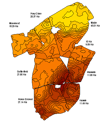
4. The field is scanned with a conductivity meter to produce a detailed soil type map of that field. Each soil type is then sampled individually. Advantages: Each soil type is mapped and sampled to produce its own indices
Disadvantages: Needs two visits, (one to scan, one to sample) |
|